
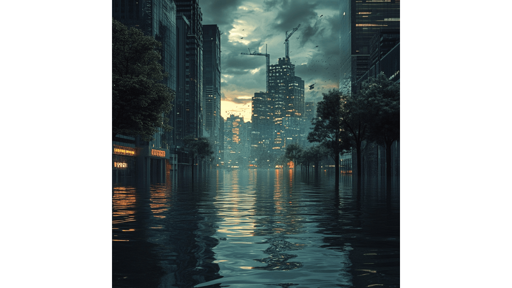
Rising sea levels have been a concern since global warming became mainstream. Coastal cities are getting flooded, and entire island nations like Tuvalu face the risk of disappearing. To avoid Atlantis-like occurrences, countries are turning to technology to stay afloat.
Technology coupled with AI is helping countries predict floods, set up measures, and plan for disasters. This article covers the various ways nations are enlisting technology to fight for survival.
How Countries are Using Technology to Stay Afloat
1. Smart Flood Prediction Systems
Floods are hitting faster and harder, but predicting them has never been easier. AI models now analyze weather patterns, satellite images, and historical data to give accurate flood forecasts. These smart systems provide early warnings. This helps people evacuate and governments allocate resources effectively.
Thanks to these prediction models, communities can prepare days in advance. The end result will be decreased casualties and economic losses.
Benefits of AI in Flood Forecasting:
- More Accurate Predictions: AI learns from past floods and continuously improves its forecasts.
- Faster Warnings: Automated alerts buy time for people to prepare and evacuate.
- Better Planning: Governments can allocate emergency aid efficiently, minimizing chaos during disasters.
- Reduced Economic Loss: Businesses and homeowners can take preventive action before floods strike.
Case Study: Google’s AI Flood Forecasting Initiative
Google’s flood forecasting system has already helped millions in flood-prone areas like India and Bangladesh. Using real-time data and deep learning models, the system provides highly accurate flood warnings. Local authorities can then take preventive action. These alerts have reduced casualties and improved disaster response strategies in vulnerable regions.
2. VPNs
Virtual Private Networks (VPNs) might not stop the sea from rising, but they play a huge role in disaster response by ensuring secure and reliable communication when it matters most. In times of crisis, information is a lifeline. According to ExpressVPN’s research on sinking nations, a private network helps emergency teams, governments, and displaced communities stay connected without disruption.
Here’s how:
a. Secure Communication
During floods, emergency teams need encrypted communication channels to coordinate rescue efforts and relief operations without the risk of cyber threats.
b. Access to Unrestricted Information
Some regions impose internet restrictions during emergencies. Access to crucial news and disaster updates is limited and this could affect casualty rates. A VPN will bypass these blocks to help people stay informed.
c. Data Protection
Cybercriminals often exploit disasters to launch attacks. VPNs shield emergency response systems from hacking attempts to secure sensitive data like location tracking and resource distribution.
d. Remote Access for Relief Organizations
To promote smooth coordination between global agencies and local teams, international aid workers often rely on VPNs to access critical response.
Example of VPN Use in Disaster Planning
Emergency response teams in disaster-prone regions use VPNs to maintain secure data sharing. For example, during major floods in South Asia, humanitarian organizations used VPNs to access blocked websites and communicate with field workers without interference.
3. Innovative Coastal Barriers
Seawalls are no longer enough. Countries are building high tech barriers to hold back the sea, combining engineering and nature to create resilient coastlines.
Examples of High-Tech Barriers:
| Technology | How It Works | Countries Using It |
| Storm Surge Barriers | Movable walls that close during storms, preventing coastal flooding | Netherlands, UK, USA |
| Artificial Islands | Man-made land masses that block waves and create buffer zones | Maldives, China, UAE |
| Mangrove Restoration | Restores natural flood barriers that absorb storm surges | Indonesia, Philippines, Thailand |
The Netherlands’ Maeslantkering Barrier
This massive storm surge barrier, one of the most advanced in the world, automatically closes when sea levels rise dangerously. Its AI system monitors water levels in real time to ensure quick action when needed. This proves that innovative engineering can help nations manage climate risks more effectively.
4. Floating Cities

When the land disappears, why not move to the water? A floating city is a very creative solution for nations losing ground to the sea. These innovative urban hubs are designed to be fully functional and sustainable, with everything from housing to food production built directly on water.
Features of a Floating City:
- Self-Sustaining Energy: Solar panels, wind turbines, and hydropower systems generate renewable energy to reduce dependence on traditional power sources.
- Modular Design: Expandable and adaptable structures allow communities to grow and evolve based on population needs.
- Built to Withstand Storms: Floating platforms use high level engineering to remain stable even in rough waters to ensure safety during extreme weather events.
- Sustainable Food Production: Aquaponic farms and vertical gardens to provide fresh food, reducing reliance on mainland agriculture.
- Water Management Systems: Advanced desalination and rainwater collection will ensure a consistent supply of clean drinking water.
Example: Oceanix City
The Oceanix project, backed by the United Nations, is leading the way in floating city development. The design includes hexagonal platforms that interconnect to form entire neighborhoods.
Each unit is engineered to float and adjust with rising sea levels which makes them a viable solution for coastal cities threatened by climate change. These cities represent a vision for a new, water-based way of life that embraces sustainability and resilience.
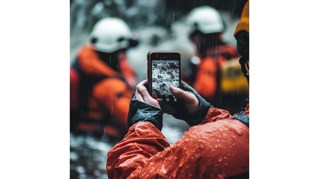
5. Drones and Robots in Flood Response
Sometimes, even with proper planning, disaster happens. Technology still comes in handy to help with the aftermath of a disaster, drones and robots especially. These unmanned systems reach areas humans can’t to deliver aid faster and save lives.
How Drones Help in Flood Response:
- Aerial Surveillance: Drones provide real-time imagery of flooded regions that helps responders assess damage and plan relief operations.
- Delivery of Supplies: Autonomous drones transport food, water, and medicine to people stranded by floodwaters. This eliminates delays caused by impassable roads.
- Locating Survivors: Equipped with thermal imaging, drones scan debris and rooftops to identify those in need of rescue, even in the dark.
- Infrastructure Inspection: Drones assess the condition of bridges, power lines, and levees post-flood to help authorities prioritize repairs.
Example: Japan’s Flood Relief Drones
Japan deploys drones to disaster-hit regions, thereby reducing the need for risky human rescue missions. These drones deliver emergency supplies and provide critical surveillance data to ensure rapid and safe responses.
6. Sustainable Infrastructure and Architecture
The key to surviving rising seas is smarter construction. Countries are rethinking urban planning to create structures that adapt to changing water levels instead of resisting them.
Examples of Sustainable Infrastructure:
| Technology | Purpose | Examples |
| Amphibious Houses | Homes that float during floods | Netherlands, UK |
| Permeable Pavements | Absorbs rainwater to reduce flooding | USA, Singapore |
| Green Roofs | Retains excess rainwater | Germany, Canada |
| Elevated Cities | Raised foundations protect urban areas from flooding | Thailand, Indonesia |
| Living Shorelines | Natural buffers using plants and oyster reefs | USA, Australia |
The Netherlands’ Amphibious Homes
The Netherlands is leading the way with amphibious homes that rest on solid ground but float when floodwaters rise. These structures are anchored to guideposts, preventing them from drifting away while allowing them to adjust to water levels.
7. Advanced Satellite Monitoring
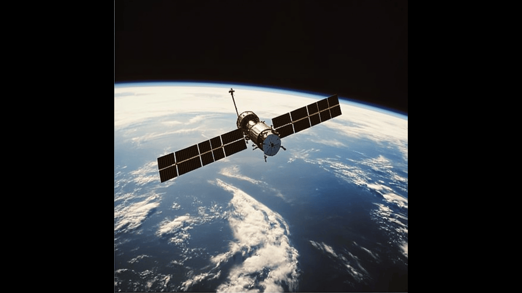
Keeping an eye on sea level rise is crucial for long-term survival. Satellites track ocean changes to provide governments and researchers with critical insights for flood prevention and response.
How Satellites Help:
- Measure Water Levels: Satellites monitor ocean height changes to identify patterns over time.
- Detect Coastal Erosion: By mapping coastlines, satellites help predict land loss and future flooding risks.
- Provide Real-Time Data: Governments rely on satellite data to make informed decisions about disaster response and infrastructure planning.
- Monitor Storm Patterns: Advanced imaging helps predict the formation and intensity of hurricanes and typhoons.
NASA’s Sentinel-6 Satellite
NASA’s Sentinel-6 is a key player in global sea-level tracking. It’s equipped with state-of-the-art radar to provide highly accurate ocean measurements. This data helps policymakers understand climate change’s impact and develop better flood prevention strategies.
The Bottom Line
Technology stems from the concept of making life easier for humans. In cases like this, technology can increase chances of survival. Thanks to prediction tools, innovative floating cities, and secure disaster communication with VPNs, countries can stay afloat.